
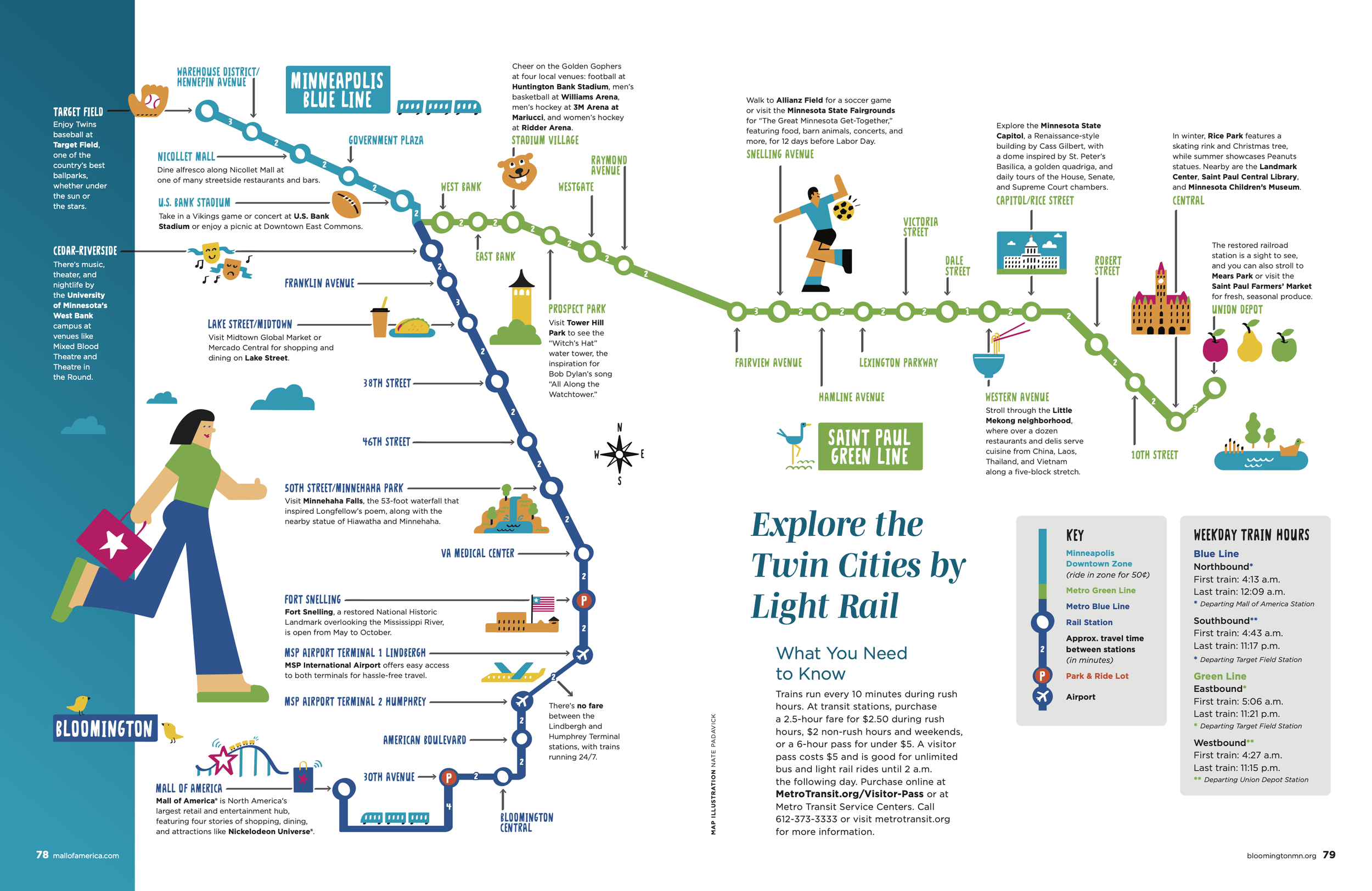

Illustrated Map of Twin Cities Light Rail
Map location: Minneapolis, Minnesota
Art Director: Natalie Messer, Greenspring Media
Description: Nate Padavick was commissioned by The City of Bloomington, Minnesota to illustrated a map of the light rail system that connects The Mall of America to the Twin Cities of Minneapolis and St. Paul. The map features notable sites such as Target Field, Minnehaha Falls, the MSP Airport, and the Minnesota State Capital. This map is included in the 2025 Bloomington/Mall of America Visitors Guide.
This map was created in Adobe Illustrator by Nate Padavick, using vector brushes and Nate’s propriety font Slender. AI was not used in the creation of this illustration.